







Find, save and share Public Notices that affect you in the area.
Search the Public Notice Portal What is the Public Notice Portal?What is the Public Notice Portal?
The Public Notice Portal carries statutory public notices published in local newspapers and is the fastest and most effective way of finding out what is happening in YOUR neighbourhood.
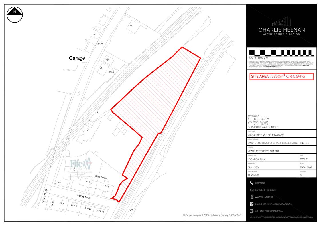
Search the Public Notice PortalPlans to breathe new life into a derelict corner of Inverkeithing could see 18 new flats built on a scrubby, overgrown site just a short walk from the town centre and railway station.
The scheme, lodged by Stephen Garratt and Fiona Allardyce, is seeking approval to build on land that is tucked away behind Hope Street and accessed from Glebe Park, and is currently a tangle of bushes, trees and old banking on the slope down towards the Inner Bay.
Long ignored by passers‑by heading for the train, it sits between the railway and existing tenements, with the former parish manse at 54 Hope Street – a category C‑listed building – immediately to the south‑east.
Under the plans, the scrubland would be cleared to make way for a single flatted block containing 18 two‑bedroom homes, with the entire ground floor turned into a parking deck.
But the patch of rough ground is no ordinary development site. It sits within the official battlefield boundary for the Battle of Inverkeithing, fought nearby on July 20, 1651, during the Wars of the Three Kingdoms.
The clash saw English Parliamentarian forces defeat a Scottish army loyal to Charles II in a brutal engagement around Ferry Hills and Pitreavie.
Historians regard it as the last major battle fought on Scottish soil in that turbulent period, with heavy Scottish casualties and Highland regiments almost wiped out.

The applicants acknowledge the sensitivity and say they are prepared to carry out detailed battlefield and archaeology assessments if Fife Council and Historic Environment Scotland deem them necessary.
Sixteen standard car spaces and two disabled bays are proposed, with residents reaching their homes via two stair cores – one with a lift – as the building steps up the slope.
Above the parking, three floors would each contain five flats, with a smaller top floor of three units, arranged so that many livingrooms face towards the water.
The design statement talks up "fantastic" views over the Inner Bay and harbour, arguing the location will appeal to Inverkeithing’s growing commuter population thanks to its proximity to the railway station and Ferrytoll Park and Ride.
They also say the project would tick several national planning boxes by reusing brownfield land instead of building on greenfield edges and by putting new homes within a "20‑minute neighbourhood" of shops, services and transport.
Each flat is earmarked for high levels of insulation, its own air‑source heat pump and a share of rooftop solar panels, while rainwater would be channelled to a new SUDS pond on site rather than into the combined sewer.
No previous planning bids have come forward for the site, and the proposal will now be tested against National Planning Framework 4 and Fife’s Local Development Plan policies on housing, design, heritage and flooding.
Neighbours and local groups will have the chance to comment as the council weighs up whether transforming a hidden, historic corner of Inverkeithing into modern flats is a price worth paying for new homes.


Share